• Greek (el-GR)
  • English (United Kingdom)
  • Русский (Россия)
  • Chinese Simplified (China)
  • Slovenščina (Slovenija)
  • Polski (PL)
  • Nederlands (nl-NL)
  • Danish (Danmark)
  • Swedish (Sweden)
  • Finnish (Finland)
  • 日本語 (Japan)
Sfakia region Sfakia region
  • Home
  • Municipality
  • Guide
    • Villages
    • Interesting sites
  • Maps
Featured

Sfakia region

Dimos Sfakion 

Sfakiá is a mountainous area in the southwestern part of the island of Crete, in the Chania regional unit. It is considered one of the few places in Greece to never have been fully occupied by foreign powers. With a 2011 census population of 1,889 inhabitants living on a land area of 467,58 km², Sfakia is one of the largest and least densely populated municipalities on the island of Crete. The etymology of its name is disputed. According to the prevailing theory, it relates to its rugged terrain, deriving from the ancient Greek word σφαξ, meaning land chasm or gorge

Featured

Settlements of Sfakia

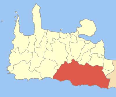
The wildest natural landscape in whole Crete. A unique place, difficult to approach, full of gorges and mountain peaks, but also with hidden spotlessly clean beaches with crystal clear waters. The unique formation of the ground played an important role in the life of the people of Sfakia. It had an effect on their temperament and as a result they created a unique civilization as we deduce from the ancient cities found in the area, such as Tarra, Phoinix, Aradena, Anopolis, Pikalissos, etc. The remains of a golden era lie in the gorges, the tablelands and the marvelous caves.

Almost all people of Sfakia claim that they come from noble Byzantine families who had been sent to Crete by the emperor. The big family of Skordilis had settled down in the wider area of Sfakia and they were the ancestors of many generations who still preserve a temperamental social diversion. People of Sfakia still preserve the ancient Cretan anthropological type.

The White Mountains (or Madares as the locals call it) take up almost the whole region of Sfakia, on the southeast of Chania prefecture, with more than 100 peaks, 57 of which are more than 2000m in height. Many of them are barren and covered in snow from autumn to spring. Here, on mountain Gigilos (2080m in height), Zeus the Kritagenis was said to have built his throne before moving it to the top of mountain Olympus (highest point: Pahnes 2.452m in height).

The word 'Sfakia' probably derives from the word 'sfaka', which is the local name for the evergreen oleander bush. Others believe that the word 'Sfakia' means 'the Land of Gorges' and that is because all these gorges with their unique and beautiful flora are typical of the area. In Chania prefecture there are almost 60 gorges, most of which are in Sfakia and are also the most imposing ones. Beginning from the west we find Tripiti gorge, which forms a natural border between Sfakia and Selino prefecture. Then there is Klados gorge. If you wish to walk through either of them, you will surely need an experienced guide.

However, the one and only gorge, as people of Sfakia say, is Samaria gorge, which has been declared a nature reserve since 1962. It is the largest gorge in Europe, 15km in length. Its width ranges from 3.5 to 150 metres and it is 500 metres in height. A very impressive feature of the gorge is the folds formed on the rocks.

The gorge contains rare species of flora and fauna, such as the Cretan wild goat (or Kri - Kri as the locals call it) as well as rare species of eagles and wild birds, which are all protected by international treaties.

You can visit the gorge only from May to October. There are more than 300.000 visitors every year. The path starts from Xiloskalo (at an altitude of 1200m) in Omalos tableland. After you go down 'ksiloskalo' you go on walking along the river through a wonderful forest with high trees and a magnificent view. 'Samaria' village lies in the middle of the gorge and it was abandoned in 1962 when the gorge was declared a nature reserve.

The area took its name after the Byzantine church of 'Osia Maria the Egyptian' (14th century) since the words 'osia' and 'Maria' can form the word Samaria. One of the nicest parts of the route is the "Doors" where there is a distance of only 3.5 metres between the two sides of the gorge and at that spot it is 500 metres in height.

Aradena gorge is smaller but equally beautiful. 150 metres above it there is the only metal bridge in Crete which is a meeting point for the lovers of bungee jumping as it is an ideal spot for their daredevil jumps.

For a milder hike, there is a diversity of wonderful small gorges taking 2-4 hours to cross such as Sfakiano, Imbros, Asfendou and Kallikratis gorge.

Kallergis, Houliopoulos  and Tavri refuges are ideal for your mountain excursions as they can offer you a very comfortable accommodation.

During your hikes you will discover that there is an awful lot of hidden caves in this mountainous area, most of which still remain unexplored. Sfakia holds 260 caves out of 1400 existing in the whole prefecture of Chania. Many of them were used as hideouts during the Venetian domination, which lasted from the 13th to the 17th century, as well as during the Turkish domination. Isolated in this almost inaccessible area of the White Mountains, people in Sfakia villages managed to maintain a half-autonomous regime and although their houses were pillaged and they were slaughtered, they never succumbed to enslavement.

Mountain Villages

Many elements of the traditional architecture are still preserved in the mountain villages of Sfakia. One or two-storey houses with small doors and windows and with inner courtyards with a well or a stone-built oven. As far as architecture is concerned, the so-called mitata are especially interesting. These are stone buildings with a domed ceiling used by the shepherds to live in and produce their dairy products.

In Afkifou village  a traditional picturesque place  - you will have the chance to visit the private museum of war belonging to Georgos Hatzidakis and admire his collection consisting of many World War II findings, found by himself over the last 50 years. The village is located in Askifou tableland and as it is surrounded by high mountains, it is and ideal place to go for a nice hike in nature.

In the abandoned village of Aradena there is still the church of Archangel Michael, with a very special dome and wonderful frescoes, dating back to the 14th century. In the same area stretches the thick pine-tree forest of Ai Giannis, which is one of the most impressive forests in the island.

On the southeast of Araden lies Anopolis. A mountain village with many beautiful stone houses, where people are mostly shepherds. An area of extreme natural beauty and a spectacular view of the southern part of Crete.

Anopolis is the home of Giannis Daskologiannis, a rebel and heroe not only in Sfakia but also in whole Crete, who organized the first important revolution against the Turkish, called Orlofika, in 1770. That was one of the most important events in Crete's modern history due to the fact that after the revolution was suppressed, the Turkish skinned Daskalogiannis alive in Herakeion and burnt almost the whole village of Sfakia in retaliation. Daskalogiannis' Revolution has recently been recognized by the Greek Nation as a National Holiday for whole Crete and will be honoured every year on the first Sunday after 17th June.

Georgios Xenoudakis is considered to be a major benefactor for Sfakia. He was arrested among others in one of the Cretan revolutions against the Turkish and sent to Egypt at the age of 8 where he was sold as a slave. Even though he was deprived of his country, his feedom and his Christian education, he managed to survive, to be educated and to return to Greece. He studied law in Athens and accomplished great deeds as real Greek and a true patriot.

In 1881, Georgios Xenoudakis was the first delegate from Crete in the Greek Parliament. In 1880, he built 13 schools in Sfakia and hired teachers, all on his own expense. He bequeathed his entire fortune to Sfakia for this purpose. After his death, his legacy, which still exists, was used for the construction of another school and the boarding school of Sfakia.

Coastal villages

Despite the wildness of the mountains, the southern coast of Sfakia faces the Libyan Sea an offers us beaches of extreme beauty. Sandy beaches at the edge of the gorges and pebble coasts having the imposingly high mountains as a background. On the west of Sfakia municipality you will find Agia Roumeli that is built on the ruins of the ancient Dorian city of Tarra. Although it is not connected to the road network, you can visit it by ship from Sougia, Paleohora or Hora Sfakion.

On the east of Agia Roumeli you will find the magnificent sandy and pebble beach of Agios Pavlos with its crystal clear waters, as well as Agios Pavlos stone church of the 10th century.

Loutro is another picturesque coastal village. A small harbour protected from the wind, with white houses with blue windows and small taverns, all reminding of a Cycladic island. During the Hellenistic period, Loutro, or else ancient Anopolis, had its own currency. Part of ancient Anopolis was the ancient harbour Phoenix, which was the only natural harbour of the coast and long before the arrival of the Venetians, it was used by Sarakini pirates as a slave market.

Next to Loutro there are many other beaches along the wonderful blue sea. Some of them are the well-known beaches of Phoenix, Likos, Marmara (at the edge of Aradena gorge) and Glika Nera, which is also the favourite of nudists.

The capital of Sfakia Municipality is Hora Sfakion, located 75km far from Chania. This picturesque little harbour could become the base for your excursions in the magnificent area of Sfakia. There are boats leaving every day for Loutro and Agia Roumeli as well as for the most south part of Europe, Gavdos; the island of mythical Calypso.

On the east of Hora Sfakion, in Komitades village, you will find the church of Virgin Mary the Thimiani where the Cretan Revolution started officially on the last Sunday of May, in 1821. However, that didn't lead to the liberation of the island but it took more revolutions until, 92 years later, Crete was united with Greece.

Heading to the east we reach Fragokastelo with the homonymous Venetian castle. In front of the castle lies one of the most idyllic and romantic beaches of the island, while at the same time the whole east coast has many other wonderful beaches such as that of Orthi Ammos with impressive sandy hills and a magnificent view of the Libyan Sea.

The Venetians built Fragokastelo in 1374 to protect themselves from the pirates. For its construction, they used hewn stones from the nearby ruins of ancient Nikita. The church of Agios Nikitas still remains in the area of this ancient town.

In Fragokastelo, in 1828, a terrible battle took place between the Turkish army and the Greeks who had as their leader Hatzimihalis Dalianis. Towards the end of May (the days of the battle) they say that you can see 'Drosoulites'  the black shadows of Dalianis' soldiers who unfairly lost their lives in the battle and as their souls are unable to rest in peace, they come back to Fragokastelo during every anniversary of the battle. They appear only at dawn and it's a phenomenon that hasn't been scientifically explained yet.

If you find yourself in Fragostelo in August, during full moon, don't miss the concerts taking place inside the castle.

FaLang translation system by Faboba
  • Home
  • Municipality
  • Guide
    • Villages
    • Interesting sites
  • Maps